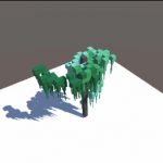
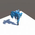
Random renders with various reflections. Made using Blender.
[1920 x 1080]


videre stella

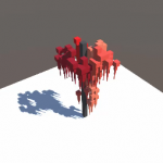
Random renders with various reflections. Made using Blender.
[1920 x 1080]
videre stella
Z-Fighting Hypercube.
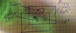
I randomly came across this interesting pattern playing around with blender. It’s essentially three glassy (RGB) cubes merging into the same location. Curious, I initially thought it to be some sort of 3d fractal caused by the reflective properties of the primatives within the scene.
Turns out, the pattern is caused by floating point rounding errors. Additional information about this phenomenon can be found in this wikipedia article.
Watch the video!
A look inside the box. (Click for higher resolution)


In this series of frames, the perspective change is .01 degrees.
Exploring the realm of floating point rounding errors!
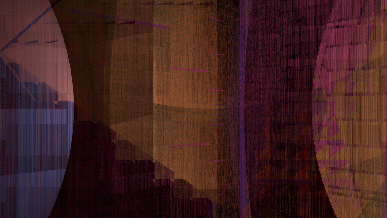
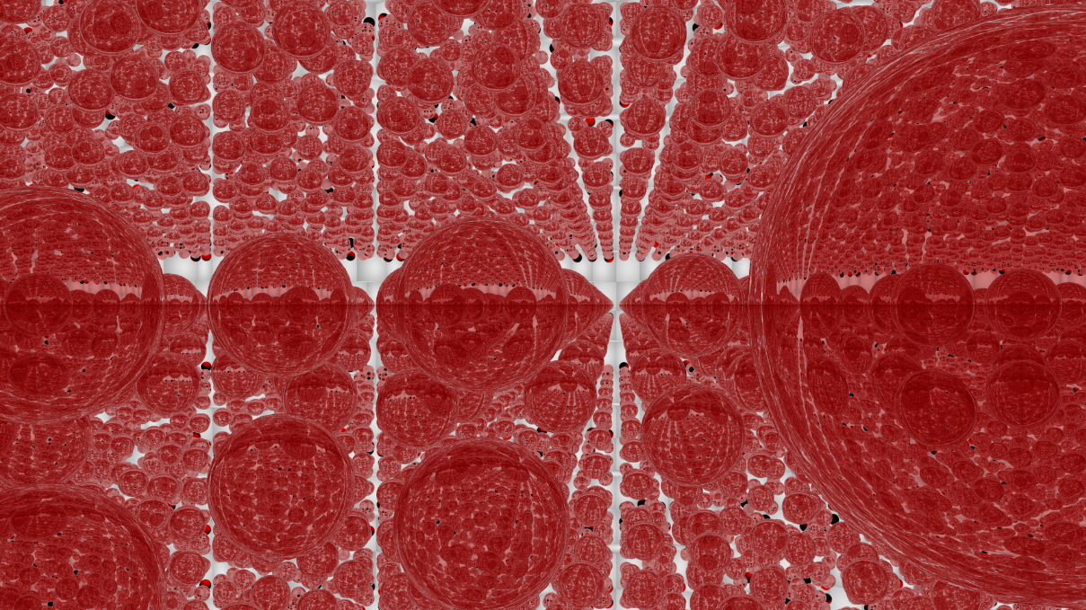
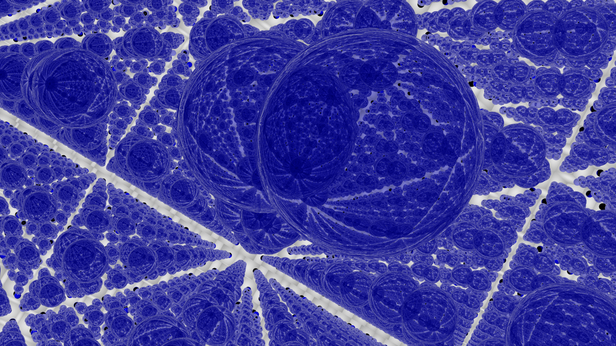
Perspective from a room in which the floor, walls, and ceiling are made out of perfect mirrors. What would all those reflections look like? The images and animations below were rendered using Blender.
Mirror depth, 5 and 10. Empty room only contains light source.


Mirror depth 50 empty room and mirror depth 50 with visible objects (Click images for higher resolution)


Experimenting with some coroutines and System.Random
Playing around with Unity3D.
Marble Race
Ball Blender
Top military expenditures by country.
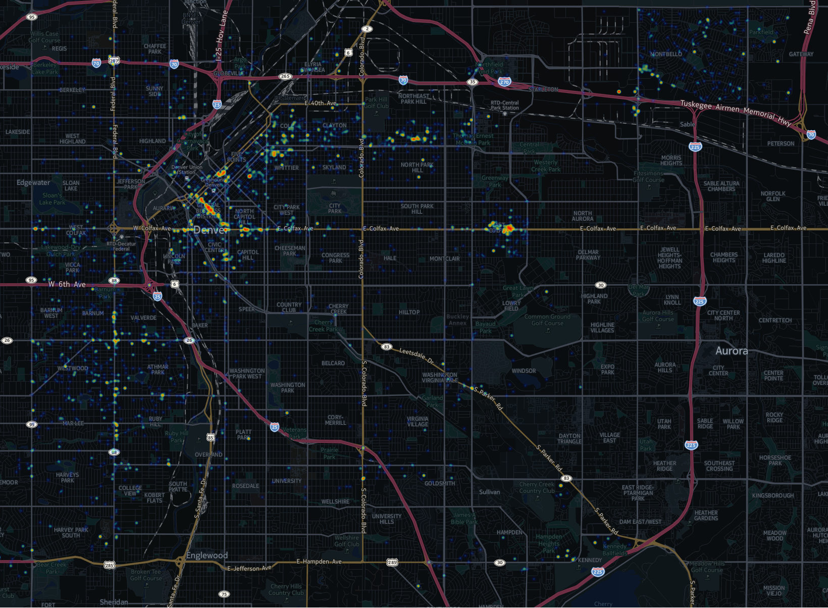
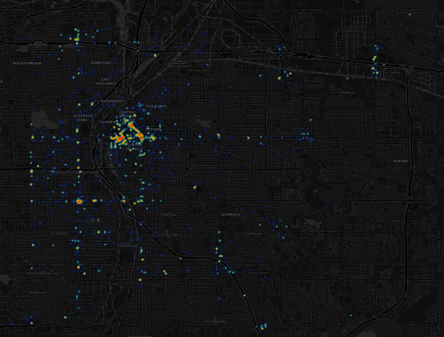
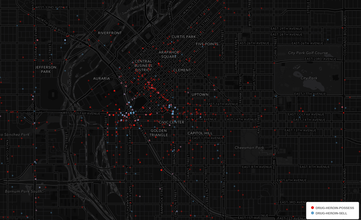
The Denver Police Department recently released an interesting crime dataset at http://data.denvergov.org/dataset/city-and-county-of-denver-crime. The data represents approximately a half a decade worth of police incident reports. Date range January 2011 through mid-March 2016.
Below are some maps I created using CartoDB. Click on the images for higher resolution.
Cocaine
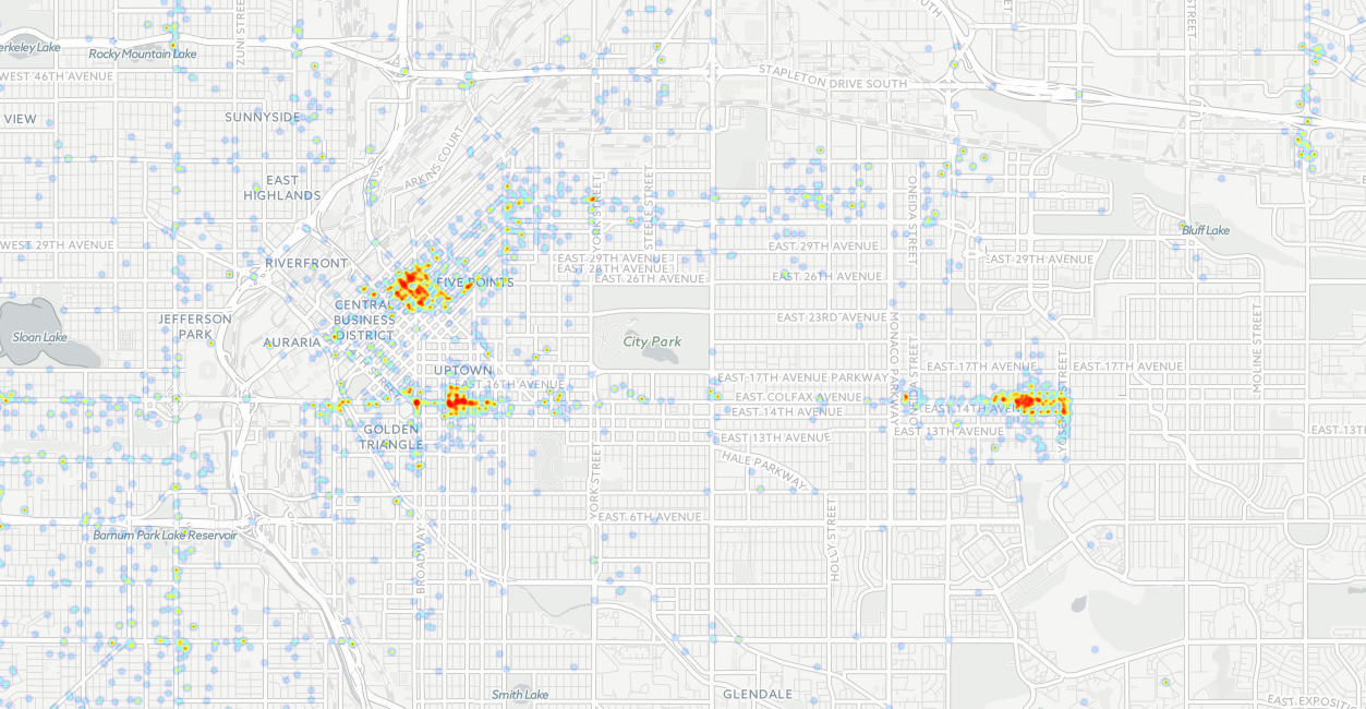
Cocaine (Sell vs. Possess)

Weapons
Heroin
Heroin (Sell vs. Possess)
Bonus Graffiti Map
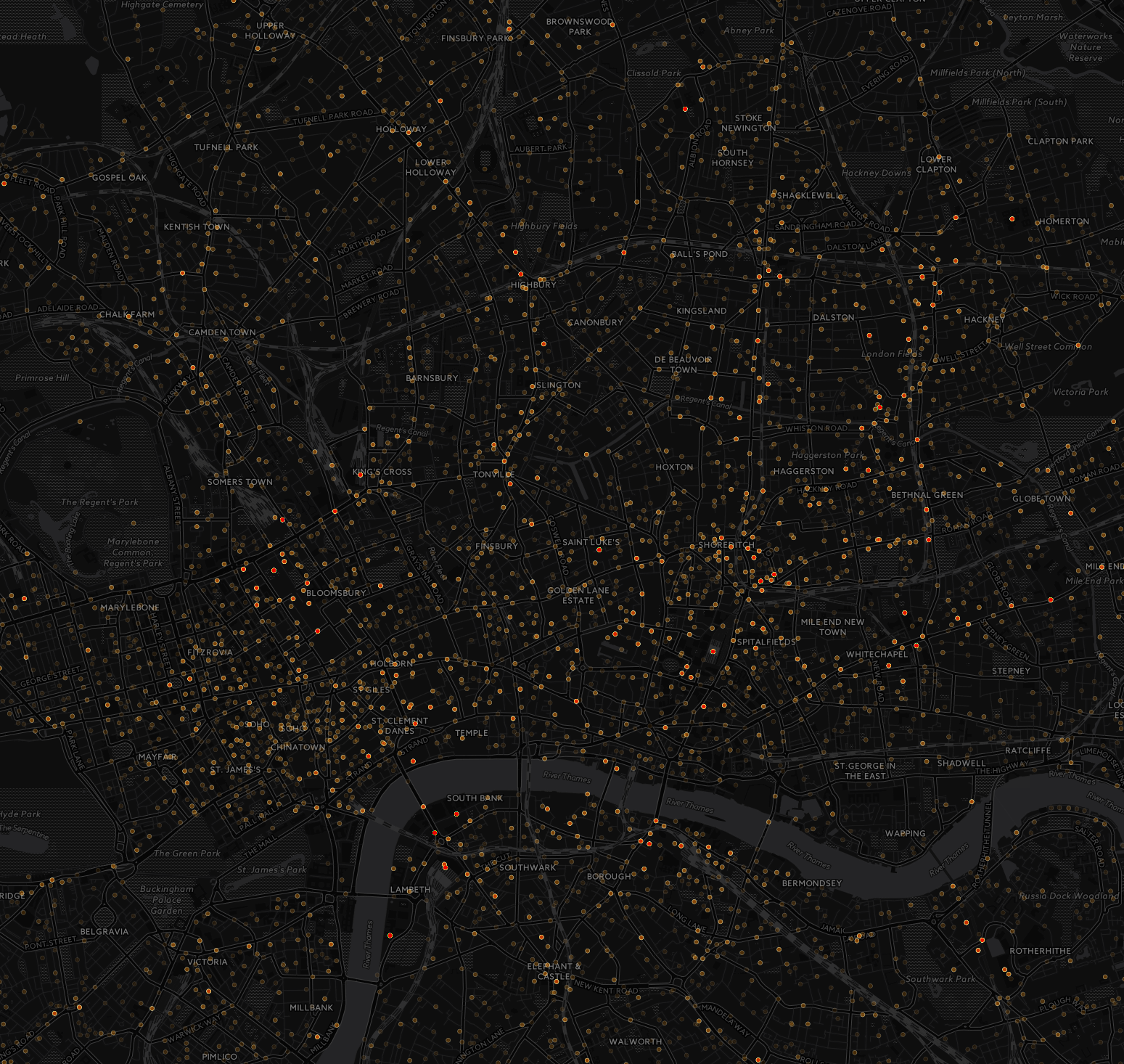
Between stuffing their faces with Jaffa Cakes, and using the term “inn’it” after every statement, these Londoninians enjoy stealing each other’s bicycles.
2014 – 2015 Bicycle theft maps.
Click to enlarge [2576×1968] 6.16mb

[1549×1466] 1.6mb
The data is from data.police.uk. C# on how it was parsed can be found here.
Original Concept Art
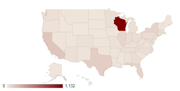
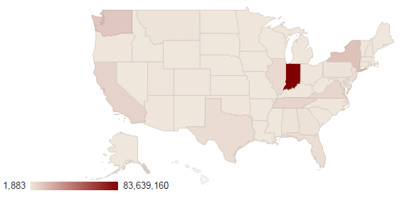
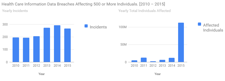
Health Care Information Data Breaches Affecting 500 or More Individuals. [2010 – 2015] This data was found on /r/datasets, https://ocrportal.hhs.gov/ocr/breach/breach_report.jsf
“As required by section 13402(e)(4) of the HITECH Act, the Secretary must post a list of breaches of unsecured protected health information affecting 500 or more individuals. These breaches are now posted in a new, more accessible format that allows users to search and sort the posted breaches. Additionally, this new format includes brief summaries of the breach cases that OCR has investigated and closed, as well as the names of private practice providers who have reported breaches of unsecured protected health information to the Secretary. The following breaches have been reported to the Secretary“
State Map by Incidents.
State Map by Total individuals affected.
Yearly Incidents and Individuals affected.
Reasons and locations

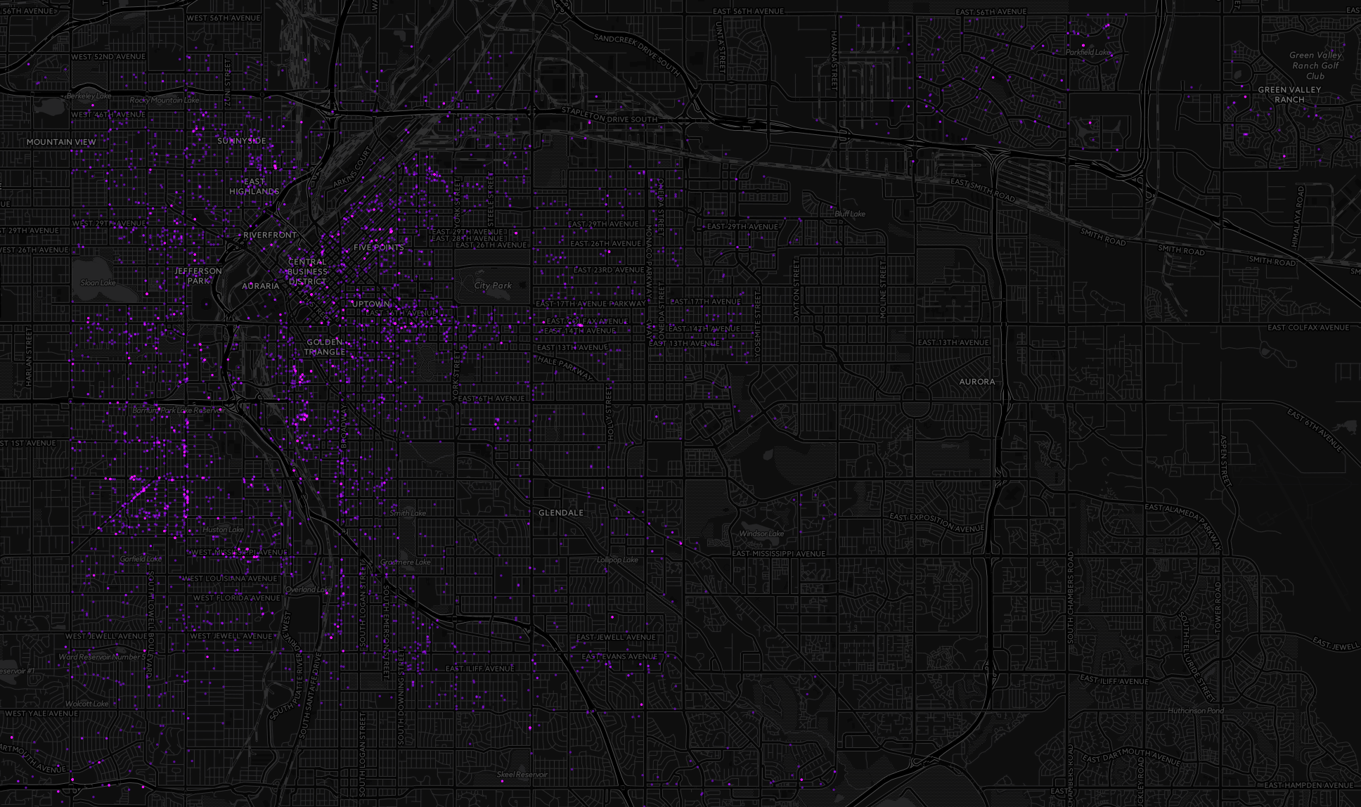
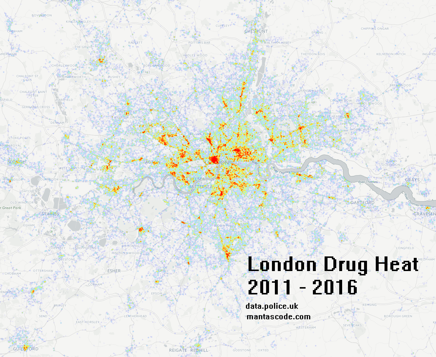
A look into open data about crime and policing in England.
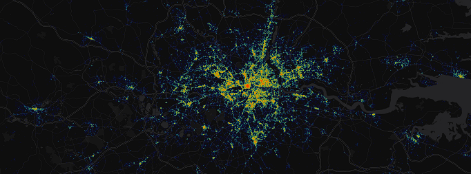
Found at https://data.police.uk/. I downloaded a date range from 2011 through 2016, ~5 years. The uncompressed filesize for all select-able policing forces was approximately 5.45 GB. A quick C# script was written to filter out only the “Drug” crime type category, and it’s long/lat degree coordinates.
The output was used to make the map below. Click map for larger size.


The downloadable data comes in a multi-directory/multi-file structure. Below is a c# console application which was created to parse the root folder, and export the specific crime type’s coordinates throughout out all the files.
Continue reading
One month of /hot/ going back from 3/19/2016 was parsed using c#. Below is a chart displaying all domains found with a frequency greater than 2.