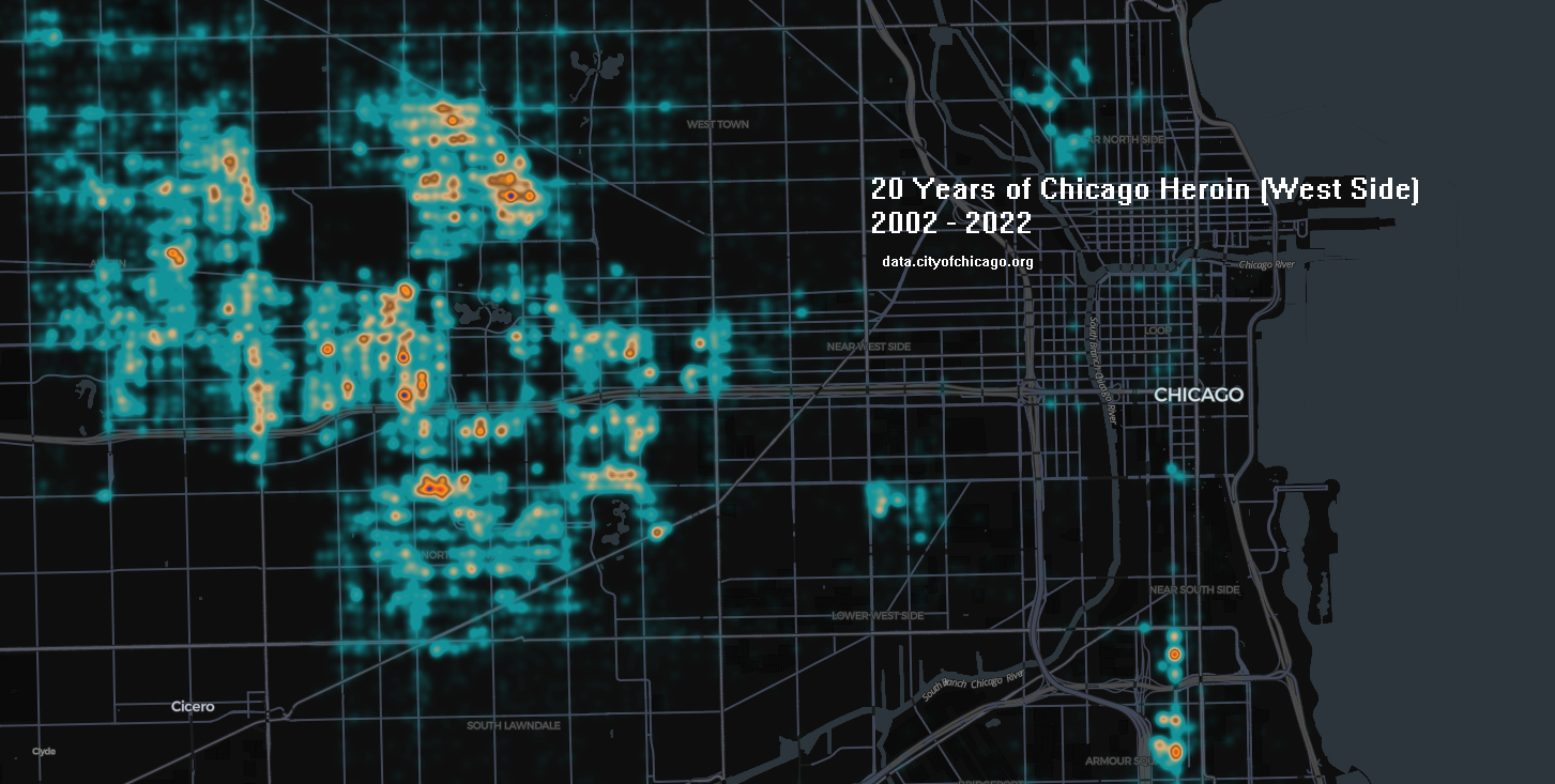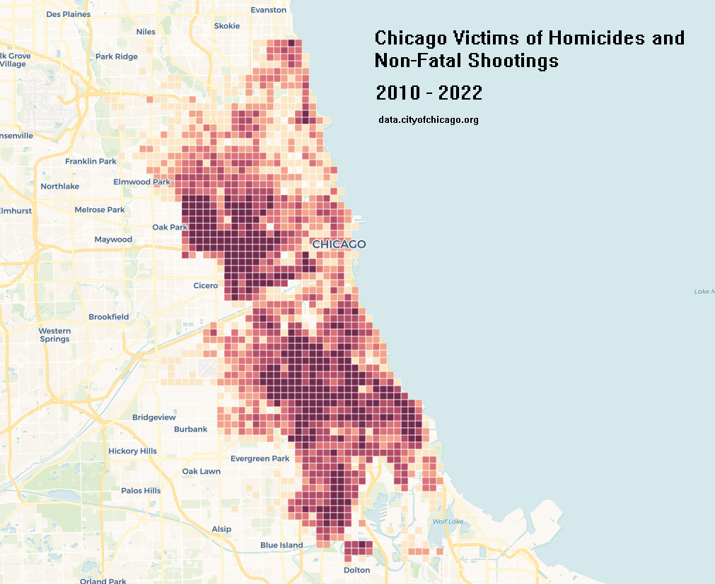
A look into Chicago Shooting Victim Data. The data comes from data.cityofchicago.org Dataset title: Violence Reduction – Victims of Homicides and Non-Fatal Shootings
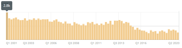
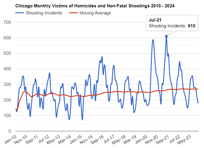
Total Shooting Incidents:
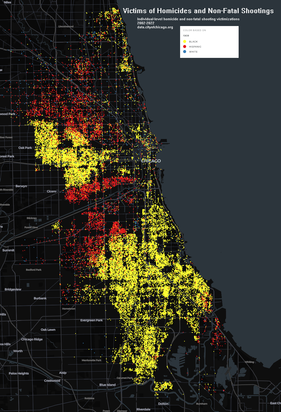
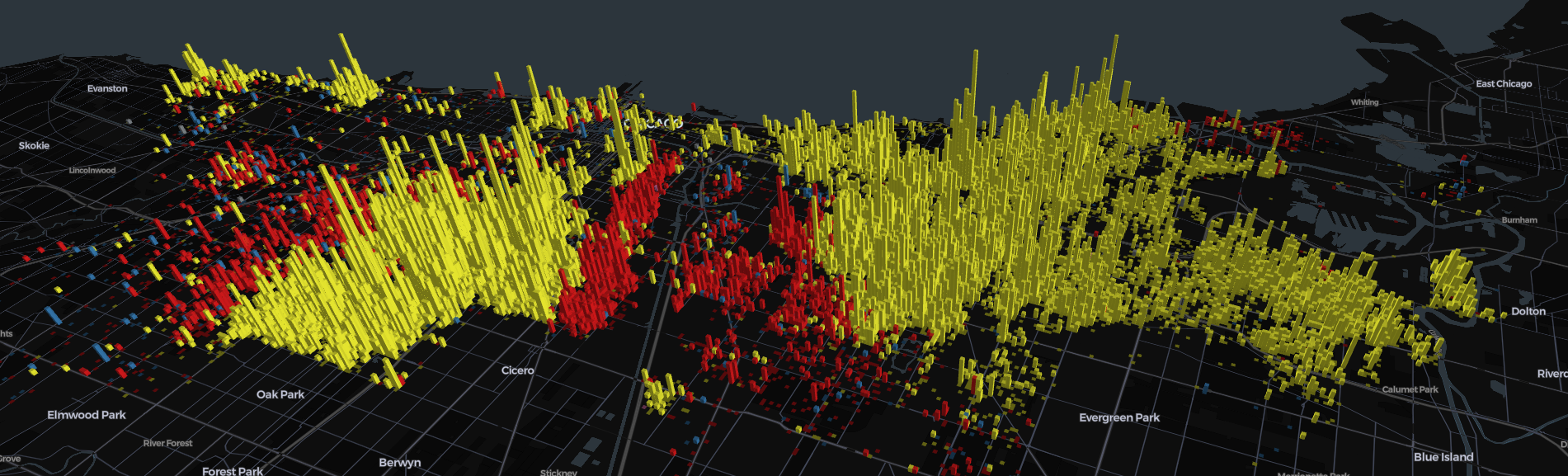
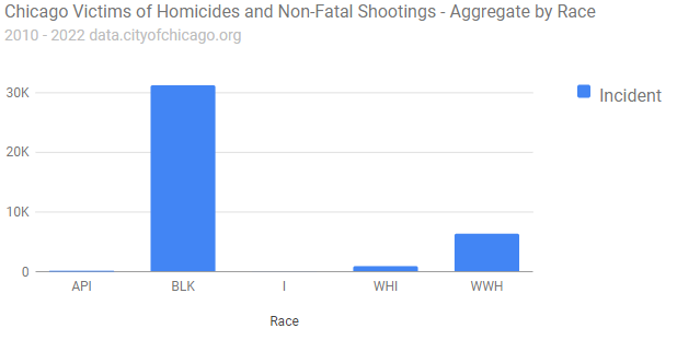
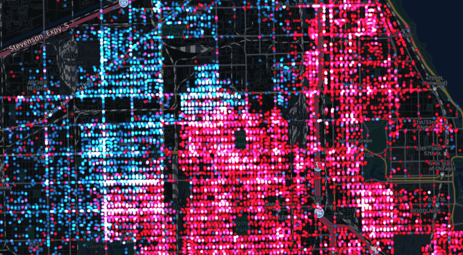
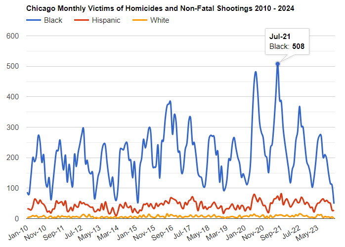
Victims by Race:
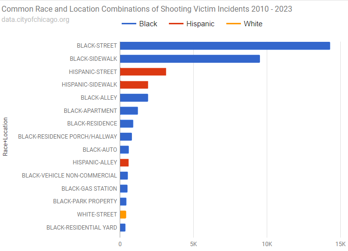
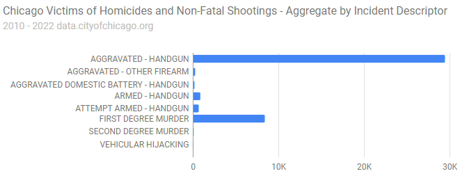
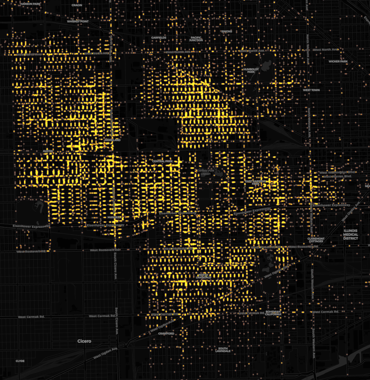
Most Frequent Race and Location Combinations: